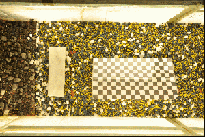
We developed the world’s leading close-range 3D stereo-vision system for gravel-bed studies. It allows instant capturing of Digital Elevation Models (DEMs), resolving over 30 million points/m2. Recently, another PhD student joined our team, and we are working on adding other features to our 3D stereo-vision system.
Publications Publications:
![]() Li, W., Bertin, S., and Friedrich, H. (2018). Combining Structure from Motion and close-range stereo photogrammetry to obtain scaled gravel bar DEMs. International Journal of Remote Sensing https://doi.org/10.1080/01431161.2018.1530809
Li, W., Bertin, S., and Friedrich, H. (2018). Combining Structure from Motion and close-range stereo photogrammetry to obtain scaled gravel bar DEMs. International Journal of Remote Sensing https://doi.org/10.1080/01431161.2018.1530809
![]() Staehly, S., Friedrich, H. and Detert, M. (2017). Size ratio of fluvial grains intermediate axes assessed by image processing and square hole sieving. Journal of Hydraulic Engineering, ASCE, 143(6), 06017005. https://doi.org/10.1061/(ASCE)HY.1943-7900.0001286
Staehly, S., Friedrich, H. and Detert, M. (2017). Size ratio of fluvial grains intermediate axes assessed by image processing and square hole sieving. Journal of Hydraulic Engineering, ASCE, 143(6), 06017005. https://doi.org/10.1061/(ASCE)HY.1943-7900.0001286
![]() Bertin, S., Friedrich, H. and Delmas, P. (2016). A merging solution for close-range DEMs to optimise surface coverage and measurement resolution. Photogrammetric Engineering and Remote Sensing, 82, 31-40. https://doi.org/10.14358/PERS.83.1.31
Bertin, S., Friedrich, H. and Delmas, P. (2016). A merging solution for close-range DEMs to optimise surface coverage and measurement resolution. Photogrammetric Engineering and Remote Sensing, 82, 31-40. https://doi.org/10.14358/PERS.83.1.31
![]() Bertin, S., Friedrich, H., Delmas, P., Chan, E. and Gimel’farb, G. (2015). Digital stereo photogrammetry for grainscale monitoring of fluvial surfaces: Error evaluation and workflow optimisation. ISPRS Journal of Photogrammetry and Remote Sensing, 101, 193–208. https://doi.org/10.1016/j.isprsjprs.2014.12.019
Bertin, S., Friedrich, H., Delmas, P., Chan, E. and Gimel’farb, G. (2015). Digital stereo photogrammetry for grainscale monitoring of fluvial surfaces: Error evaluation and workflow optimisation. ISPRS Journal of Photogrammetry and Remote Sensing, 101, 193–208. https://doi.org/10.1016/j.isprsjprs.2014.12.019
![]() Bertin, S., Friedrich, H., Delmas, P., Chan, E. and Gimel’farb, G. (2014). DEM quality assessment with a 3D printed gravel bed applied to stereophotogrammetry. Photogrammetric Record, 29(146), 241-264. https://doi.org/10.1111/phor.12061
Bertin, S., Friedrich, H., Delmas, P., Chan, E. and Gimel’farb, G. (2014). DEM quality assessment with a 3D printed gravel bed applied to stereophotogrammetry. Photogrammetric Record, 29(146), 241-264. https://doi.org/10.1111/phor.12061